Large-Scale
Solar
Panel Mapping from Aerial Imagery
Up-to-date
maps of installed solar photovoltaic panels are a critical input for
policy and financial assessment of solar distributed generation. Such
maps are not available for large areas. We train a deep convolutional
network with 12
square kilometers of training data that are manually labeled, which reliably maps
solar panels in imagery covering 200 square kilometers in two cities.
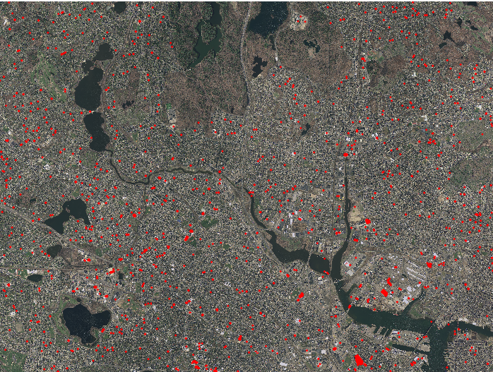
We use 0.3 meter resolution aerial images with RGB bands. Each image
below is of size 40,000 * 30,000 pixels. Red polygons in images below
are detected solar panels.
Boston, MA
San Francisco, CA
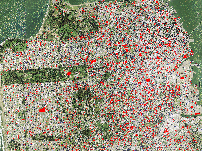
Network output for an area in San
Francisco (detections are marked in transparent red)
Please refer
to the following paper for details.
Jiangye
Yuan, Hsiu-Han Yang, Olufemi Omitaomu, and Budhendra Bhaduri,
Large-Scale Solar Panel Mapping from Aerial Images
Using Deep Convolutional Networks,
IEEE International Workshop on Big Spatial Data
,
2016. [pdf]