In order to obtain
building footprint maps that can be used in GIS systems, we
need to convert pixel level labels from deep neural networks into
polygons, or vector data. A straightforward method is to treat each
building boundary pixel as polygon vertex. However, such a method
creates unnecessarily complex polygons, leading to large map files and
slow data processing.
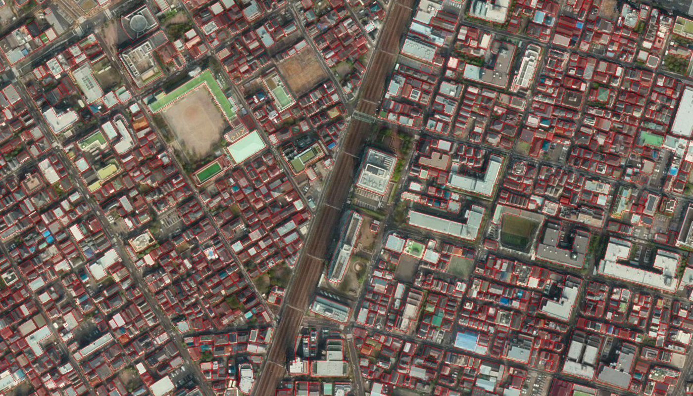
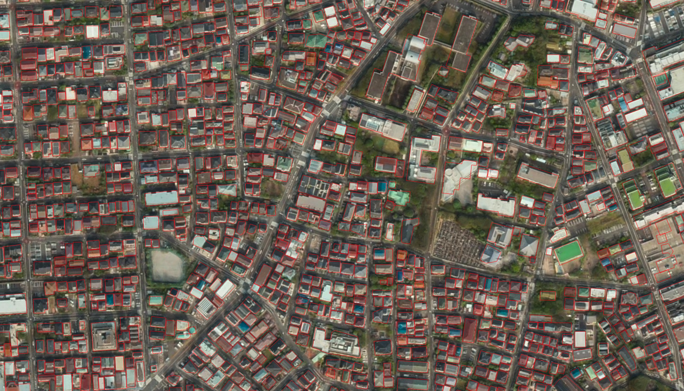
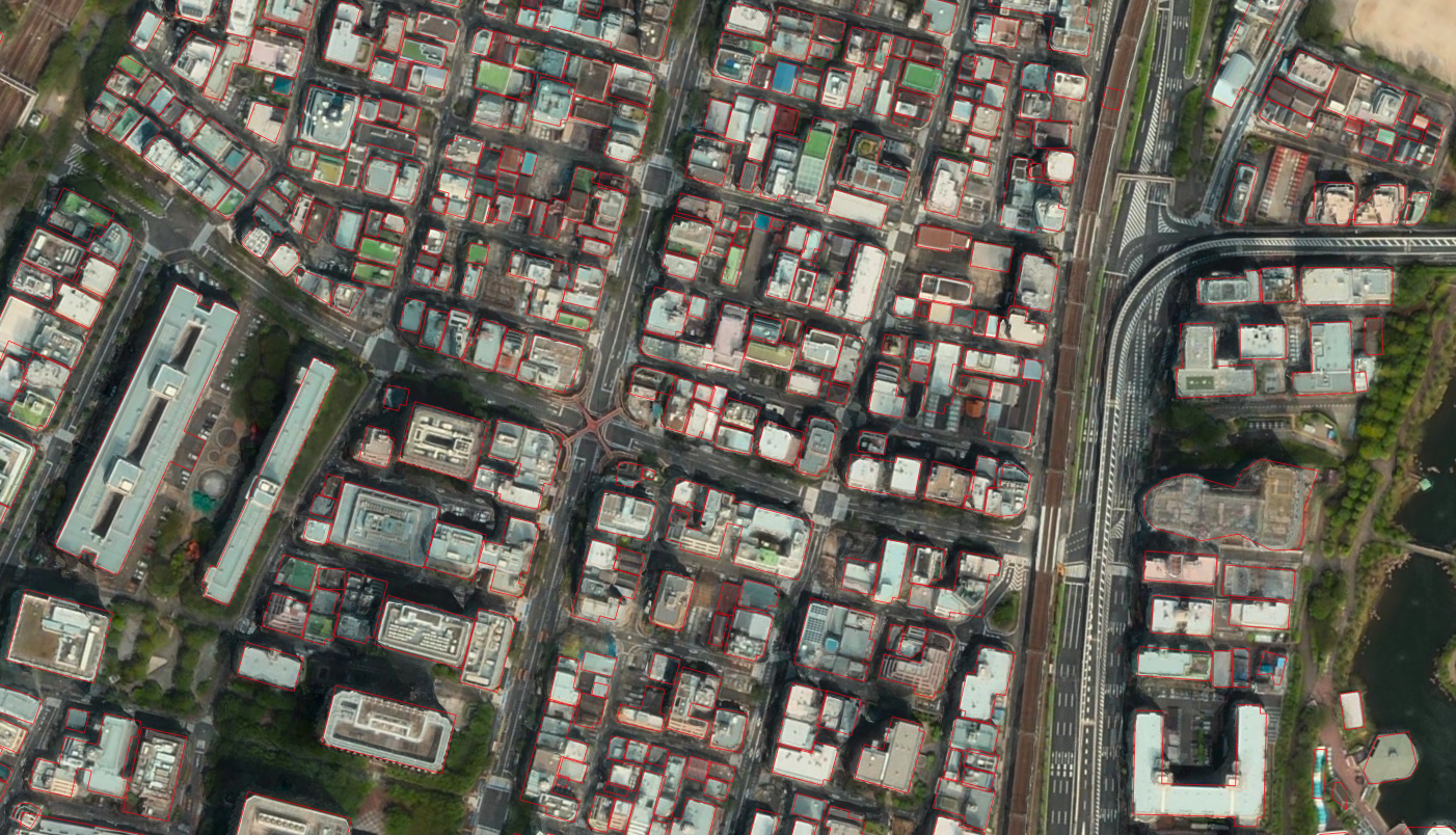
We design a polygonization method that combines low level image feature
fusion and rule-based geometric simplification. The method turns pixel
labels into polygons similar to those from manual delineation, while no human intervention
is needed. The method processes 0.5 m resolution images covering a 100
sq. km area in 20 minutes. Figures below show zoom-in views randomly
selected from the area, where resulting polygons are overlaid with
input images.
Auto generated building footprints
Auto generated building footprints
Auto generated building footprints
Please address questions
to jiangye07-at-gmail.com