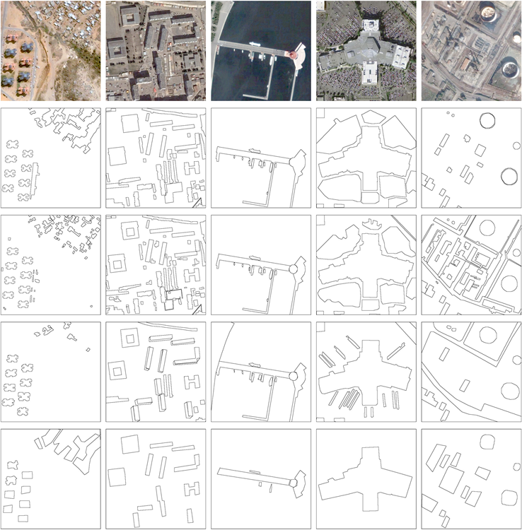
Aerial Image Segmentation Dataset

This dataset is provided for research on aerial image segmentation. The dataset contains 80 high-resolution aerial images with spatial resolution ranging from 0.3 to 1.0. The image set contains different scenes, including school, residential, city, warehouse and power plants. The size of each image is 512-by-512 pixels. Four human subjects were assigned to manually segment the images. The following figure shows five images in the dataset and the corresponding human segmentations.

Examples

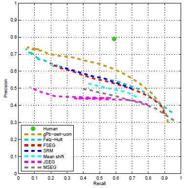
The plot below shows the benchmarking results of 7 segmentation algorithms. Please refer to our paper for details.

Evaluation

Please cite the following paper if you use this dataset.

Jiangye Yuan, Shaun S. Gleason, and Anil M. Cheriyadat, “Systematic Benchmarking for Aerial Image Segmentation,” Geoscience and Remote Sensing Letters, vol. 10, pp. 1527-1531, 2013.

You can download the images and human segmentations from here.

Please address questions to yuanj at ornl dot gov.