Automatic
Generation of Building Models Using 2D Maps and
Street View Images
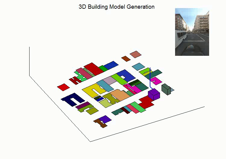
We introduce a new
approach for generating simple 3D building models by
combining building footprints from 2D maps with street level images.
Building heights are estimated by projecting building footprints onto
images and comparing with image features. The height information
together with building footprints produces box-like building models.
The following demo shows that the method uses Google Street View images
and building footprints from GIS maps for 3D model creation. To
generate such models often requires aerial
sensing data that are expensive to collect (e.g., LiDAR data), while we use data sources that
are widely available and easy to access.
Please refer
to the following paper for details.
Jiangye
Yuan and Anil M. Cheriyadat, Combining Maps and Street Level Images for
Building Height and Facade Estimation,
ACM SIGSPATIAL Workshop on Smart Cities and Urban Analytics,
2016. [pdf]
Please address questions
to jiangye07-at-gmail.com.